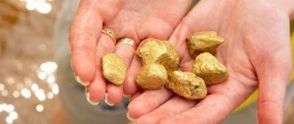
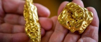
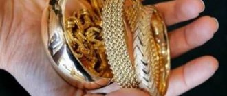
The Ural region is rich in many different minerals. Gold is also found here, which is mainly found in deep mines. There are small and large deposits of the precious metal in the region. Gold mining in the Urals using artisanal methods, according to maps, has been going on for more than one century. The oldest deposit of this metal is hidden in the local mountains. Today, both large companies and private miners are looking for aurum.
Vishera district
In the Vishera region, gold is found mainly in the form of small nuggets weighing from 1.5 to 200 g, mined on the Samenka River.
Many nuggets were found in the upper reaches of the Sosva River along the Artelny ravine at the Tulaika mine. A nugget weighing 20.2 g was found on the Sosva River in the Voskresensky section of the Ivdel region. A large number of nuggets weighing from 50 to 500 g were mined on this river at the Maslovsky mine in the Serovsky region. In the same area to the south, nuggets were found on the Makaryevka River (weighing 38 g ) and on the Peschanka River (weighing 253 g).
Particularly noteworthy is the placer of the Northern Zaozerie - Vladimirovskaya, where gold and platinum were found together, studied by Yu. P. Evensen (1938), who described the intergrowths of gold crusts on platinum nuggets.
Isovsky district
In the Isovsky region on the Nyasma River, Lyali River system, cases of nugget finds are also known: in 1934, a nugget weighing 22.2 g was found; in 1936, three nuggets carried 47.2, 28.5 and 85.5 g.
According to archival data, nuggets weighing 400 g or more were found here.
To the south, in the placers of the Severnaya, Yegoryevka, Petrovka, Vargarinka and other rivers flowing into the Poludenka and Tiskos rivers of the Koiva River system, gold was distinguished by the size of gold particles. The placer on the Shaldinka River, a tributary of the Koiva River, was distinguished by a significant content of nuggets, in which the amount of metal in nuggets larger than 1 g was about 19%. During exploration, nuggets weighing up to 12 g were encountered, and during exploitation, nuggets weighing up to 30 and 100 g.
In the Predatory Log (the right tributary of the Ayva River, system of the Salda River) in 1934, a plate-shaped nugget weighing 1800 g and measuring 21x9x0.8 cm was found. The placer of the Salda River was also distinguished by the presence of nuggets that made up at least 13% of the total gold content.
Small nuggets were found in placers of the Bol Namenaya River and its tributaries, the Chekmenya and Lomovka rivers, in quantities of 1 to 8% for the former and 17.5% for the latter. In the placers of the Talaya River, a tributary of the Is River, and the Roga River, a left tributary of the Vyi River, nuggets weighing from 1 to 100 g were often found.
Ural today
The gold of the Urals was described by Herodotus; Lomonosov made an assumption about where the element could be found and how to look for it. Why are the Urals and the territories adjacent to the region rich in Au? There are logical explanations for this:
- There is no permafrost.
- The climatic conditions are favorable.
- Availability of accessible natural resource extraction sites.
Climate conditions and other factors influenced the region's lands and made them some of the richest. According to experts, about 15% of all our country’s gold is located in the Urals.
Au can be mined in several ways:
- work in mines;
- water rinsing;
- search for precious metals in dumps.
Metal mining using the mine method is one of the most difficult and dangerous. But in this way, exploring the earth step by step, it turns out to find the greatest amount of gold.
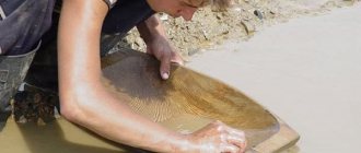
Wanting to discover metal, prospectors wash river water in the hope of finding another nugget. This is hard work that requires diligence and patience. Au, as before, is washed using a sluice, and other devices are also used.
At dumps they work with a metal detector. The development takes place in places where a noble element has already been discovered. By exploring deposits that have already been developed, it is unlikely that you will be able to find a large amount of precious metal, but there are exceptions to any rule.
Today, there are several large companies operating in the Urals that are engaged in the exploration of new deposits, the development of already discovered ones and the exploitation of those deposits that have been recognized as economically profitable. Miners can search for Au independently from companies, but they must have a license to mine gold. Therefore, people often sign contracts with those persons who have such permission. In this case, workers are delivered to the mining site and provided with equipment.
Gold mining in the region has no intention of stopping. Despite the fact that gold has been mined in the Urals for several centuries, production volumes still remain at the same level. The rich lands of the Urals attract not only prospectors, but also investors who are willing to explore new deposits.
During the Soviet era, mostly alluvial deposits were being developed, and primary deposits were considered unpromising. The reason was that the development of primary deposits required financial investments. Today, primary deposits are also being developed, progress does not stand still, and what was previously considered unprofitable today brings good profits.
If we talk about specific places where precious metal can be found, then such a map does not exist. Geologists say that you can search for gold throughout the Urals. But before starting search procedures, you should familiarize yourself with archival documents and draw up a plan.
Gold-sulfide-quartz vein
For many years, gold mining was carried out in the Urals; there is no doubt that the precious metal exists in the region. But not only the Urals and its lands are rich in Au. There are several regions in Russia that are considered promising. The gold mining industry is actively developing; Despite the fact that reserves of the precious metal are constantly decreasing, Au mining is only gaining momentum. Since gold is a guarantee of a stable economy, a sign of the well-being and prosperity of the country.
Nizhny Tagil district
In the Nizhny Tagil region, nuggets were found on the Ashka River, a tributary of the Mezhevaya Utka, on the Serebryanka River and its tributaries. On the Malaya Telyanya River there were nuggets weighing up to 2.4 kg.
From the Nizhny Tagil region, G. Rose described an octahedral gold crystal. According to the analyzes of G. Rose (1836-1842), the gold sample from two placers in the Nizhne Tagil region was 87 and 90-91-94.
In the Verkhne-Tagil region, at the Aleksandrovsky mine, gold nuggets weighing up to 5 kg were encountered.
Nevyansky district
In the Nevyansky region, in the placer of the Granevoy Log, a tributary of the Karabay River of the Cherny Shishim River system, 60-80% of the total metal were nuggets weighing over 1 g, among which there were tens and hundreds of grams, and two nuggets weighed 1164 and 1147 g. On the Malaya Bynga River There were gold crystals with clearly defined crystalline edges.
But on the Karabay River, up to 10% of all metal was made up of nuggets weighing over 1 g, and on the Sukhoi Karabay River almost exclusively nugget gold was mined. In the Neiva River valley, a significant amount of gold was mined in the form of nuggets weighing up to several hundred grams.
In the placer of the Udarnik mine on the Bynge River, a tributary of the Neiva River, nuggets weighing several tens of grams were often found, among which one weighed 925 g. The nugget was elongated, with blunt smoothed ends, in the middle part with tubercles reflecting its crystalline structure, and depressions - imprints minerals of the host rock.
Gold nuggets from the placer discovered in 1926-1927 attracted particular attention. 3 km northeast of the village of Severo-Konevskoye near the Redkinsky gold-quartz mine. It is assumed that their primary source was the Tenigip quartz vein, about 200 m long and 0.4 m thick, mineralized with pyrite, chalcopyrite and galena.
The rocks that make up this area are represented by porphyrites and granites, the placer is located in a flat small basin - a lowland with unclearly defined sides. In the spring, when the snow melted or after heavy rains, a stream flowed through it. The thickness of the deposits is 1.5–2 m.
More than 100 nuggets were found in clay layers, partly on the soil, all of them were confined to a narrow (about 10 m) strip stretched along the spoon. The size of the nuggets varies, from 4 to 80 g. Occasionally, nuggets intergrown with quartz were found. Along with flat nuggets, there were crystals of octahedral and dendritic shapes, significantly smoothed.
It is interesting to note the method used by the team of prospectors when searching for nuggets. Since the nuggets were in clay layers, washing them was difficult on butars, so the clay was planed in thin layers with flat shovels, and the nuggets were easily discovered. This led to the fact that the gold-bearing ravine became known among the miners of the Nevyansky region as the “Strogany ravine”.
The reason for the unusual occurrence of nuggets in clay layers should be explained by the slight slope of the ravine to the low velocity of the water flow. Under these conditions, the nuggets, sinking down, were retained on the deposited clay layers.
Placers
Gold placers in the Urals are located in areas located:
- near Magnitogorsk and Tagil;
- on the eastern part of the mountain range;
- in the central part of the Urals.
The upper reaches of the Suunduk River deserve special attention. It flows along the Ural mountains through the territory of the Orenburg region. At the same time, the upper layers of local placers have long been worked out. Currently, the development of layers that lie deep underground is underway.
Mostly alluvial placers are found here. They are formed due to the gradual transfer of rock mass, which includes gold veins. Such placers are often located in river valleys. In such deposits the gold is well rounded. That is, the metal is presented in the form of grains with clear edges.
Gold-bearing layers in the territory of the Ural placers are often concentrated in a certain zone. The maximum length of such deposits reaches 5 kilometers. Precious metal in local placers usually lies at a depth of 10 meters. There are also upper layers (1-3 meters) and deep layers (up to 60 meters).
The concentration of gold in placers varies. It varies from 0.01 to several milligrams in each cubic meter of mined ore material. Whole nuggets are also found in the Ural Mountains.
The attractiveness of local placers, from the point of view of private miners, is due to several factors. Firstly, there are more than one hundred of these deposits in the Urals. Secondly, they are formed by erosion of rock, due to which gold-bearing layers are formed on the river bottom. You can also look for metal in the area of the old riverbed. In other words, in the area where the river used to flow.
Placers in the Urals are a rich source of gold. Such deposits are found in various areas of the Siberian mountains, both close to populated areas and at a considerable distance from them.
Sverdlovsk district
In the Sverdlovsk region, in many areas, not only rounded nuggets, but also gold crystals were extracted from placers (Rose, 1881).
At the Pervomaisky mine on the Klyuch River north of the Berezovsky mine, gold was mined almost exclusively in the form of nuggets weighing several tens, often hundreds of grams.
At the Mostovsky site, clearly defined crystals, dendrites and lamellar forms of gold were encountered. The forms of intergrown crystals of octahedrons and rhombic dodecahedrons were not uncommon, but dendrite-like and thick-wire forms were more often found. Most of these samples are mentioned in the catalog of the museum of the Leningrad Mining Institute, compiled by A. V. Kupffer (1911).
In the area of the Berezovsky plant, a wide variety of very interesting crystalline forms of gold were observed, also described in the catalog of A. V. Kupffer.
G, Rose (1831) described a rhombohedral crystal of gold from the vicinity of Sverdlovsk. Gold from the Sverdlovsk region has always been distinguished by its high fineness (92-95). In the Shabrovo placer, a lot of nuggets were mined with an exceptionally high purity - 98 (analysis by Rose, 1831) with a silver content of only 0.16%, copper 0.35% (Ivanov, Perelyaev, 1941).
Pervomaisky village and ancient mine
If you drive a little further along the road, the small village of Pervomaisky begins. At the entrance to it, the so-called “author’s” village “Severnaya Sloboda” is being built.
, the Mostovsky gold mine arose here . Residents were engaged in artisanal fishing. Thus, a new settlement gradually grew, which later received the name Pervomaisky. The Pervomaisky Klyuch river flows through it.
In 1877, a chapel was built here. In 1881, it was rebuilt into a single-altar wooden church , consecrated in the name of St. Nicholas the Wonderworker. It is interesting that the iconostasis for her was purchased from the church in the village of Gornoshchitsky. In 1885, a parish school was opened in the village. In 1930, the church was closed and the dome and bell tower were demolished. The building was given over to the club, thanks to which it has survived to this day. According to the 2010 census, only 68 people lived in the village of Pervomaisky.
In the forest, about a hundred meters east of the outskirts of the village, you can see an ancient mine. There are several small quarries and pits here. The site is noted on Wikimapia as a chromite mine .
Polevsky district
In the Polevsky region, in placers along the Zyuzelsky ravine in the Chusovaya River basin, exceptionally interesting gold crystals were found, described by Helmhacker in 1877.
Here, on December 15, 1935, a gold nugget weighing 13.8 kg was found. It was discovered by a team of prospector Paltsev in Nikolsky Log, a right tributary of the Chusovaya River, 1.5 km northwest of the village of Kosoy Brod.
The nugget has the appearance of a thick, oblong, as if crumpled plate 38 cm long, 8-13 cm wide and 1.5-6 cm thick. The color is dull yellow, in places with a reddish-brownish tarnish. The planes and lateral edges are smooth, only in the longitudinal depressions the tuberosity is preserved, which indicates long-term grinding of the nugget with sand and pebble placer material. The nugget lay at a depth of 4 m on a raft of weathered siliceous-mica-carbonaceous shales of a dark brown color. Despite the overall high content, small nuggets weighing up to 12 g were also found in the placer.
In addition to the nuggets, which were distinguished by their strong roundness, the placer also contained small gold, distinguished by slight polishing in the form of irregularly shaped grains and rough tablets. The reason for the co-presence of two morphological varieties of gold remains unclear.
The origin of the main nugget is unclear, but since its horizontal movement was undoubtedly short, it is customary to associate it with abundant end gold-bearing veins on the right side of the Nikolsky Log placer. The discovery of the nugget is essentially accidental, since it was discovered in the side of the placer 50 years after the mining of the site, and therefore it can be assumed that in addition to it, other large nuggets remained in the side pillars that had not previously been mined due to the low content of fine gold in them.
Kyshtymsky district
In the Kyshtym region, the spot gold of the southern and middle parts of the Kaslinskaya dacha from the placers of the Bol, Mauka, Koganki, and Chernoy rivers was studied by A. V. Nikolaev (1912). The gold crystals he selected from among the nuggets did not generally differ in interesting shapes. The most common shapes were rhombic dodecahedrons, octahedra, and cubes.
All crystals are developed incorrectly, in any one direction, mainly along the fourth-order axis, less often along the third-order axis. Twins along the octahedral face (one crystal) are very rare.
The crystals are generally small, the planes of the faces are matte, not suitable for measurement with a goniometer. There are crystals both single and in the form of intergrowths. The silver content in a gold sample from these placers is from 6 to 15% (Ivanov, Perelyaev, 1941).
Miass district
In the Miass region, placer gold became known earlier than in other regions of the Urals, and its mining began with the discovery of nuggets in June 1824 at the Tsarevo-Alexandrovsky allotment of the gold mine. Danilevsky (1825) describes this event as follows: “On June 16, two nuggets were found - weighing 7 pounds. 39 gold (3.04 kg) and 3 lbs. 95 gold (1.6 kg). On September 23, a nugget weighing 8 pounds was found. 7 gold (3.3 kg) and others smaller: 2 lbs. 5 gold; 2f. 90 gold; 3 f. 7 gold; 3 f. 63 zol, and 4 f. 39 ash, (0.84; 1.22; 1.26; 1.49 and 1.66 kg).”
Nugget weighing 3 lbs. 63 gold (1.49 kg) “...especially deserves attention due to the excellent formation of various kinds of crystals on it,” writes Danilevsky, and adds: “... this amazing single combination of gold treasures in one place put the mine on a par with all the ancient richest gold mines and in all fairness it deserves that the learned world should pay attention to it.”
The first and largest nugget weighing 3.04 kg, according to Danilevsky, lay in a hole at a depth of 1.5 arshins (1 m) and was strongly compressed with the rock that contained it.
In 1826, on October 25, a nugget weighing 24 pounds was found. 68 gold (10.1 kg), striking with its extraordinary size as “today the only one, almost a rarity in the whole world” (“Mining Journal”, 1842, No. 11).
The wealth of gold in the Tsarevo-Alexandrovsky and Tsarevo-Nikolaevsky allotments, especially the finds of numerous large nuggets in them, attracted the attention of scientists. A. O. Ozersky described the cases of the discovery of nuggets and the conditions for their location: “both branches are located on both sides of the Tashkutarganka River, which flows into the Bolshoi Iremel River, a tributary of the Miass River. The Gashkutarganka River was gold-bearing throughout its entire length, and at its top the gold is larger, and as it approaches the Miass River, it gradually becomes smaller.”
The primary source of placer gold in the Tashkutarganka River is the ore deposit located in its upper reaches. Discovered in 1796, processing of the ore extracted from it was started by the gold crushing factory of the Miass plant in 1799. Extraction of gold by amalgamation continued until 1811, and due to the insignificant amount of gold extracted (18 kg), as well as high costs with a relatively low price for The gold factory was closed. This was also influenced by the profitable processing of placers on the mentioned allotments, which yielded during the period 1824-1826. up to 6.5 tons of gold. The gold content in the placer of the Tsarevo-Nikolsky allotment in some places reached up to 10 kg per ton of sand, and during bulk washing on average it was at least 250 g/t with the presence of a significant number of large nuggets, including two especially large ones - 3.6 and 8 kg.
In March 1826, a nugget weighing 9.1 kg was discovered in the Tsarevo-Aleksapdrovskaya placer, half a kilometer northeast of the Kashcheevskoye primary deposit.
In 1837, both placers, bordering each other along the bed of the Tashkutarganka River, seemed close to depletion, and then the owners began to develop the riverbed, for which a dam was built in the upper reaches of the river and by 1842 the riverbed was mined, and a small area remained untouched under the washing factory, located one kilometer northeast of the primary deposit, on the border of two famous placers.
In order to sample the piece of placer that remained under the factory, which did not differ in anything special in terms of gold content, it was decided to demolish its structure. Unexpectedly, under the very foundation of the factory, a nest with an unusually high gold content was encountered - up to 0.2-0.3 kg in 16 kg of sand. The size of the nesting accumulation of gold was insignificant: 80 cm in length and 10 cm in thickness with an insignificant width.
A. O. Ozersky further writes: “Finally, on October 26 of last year (1842), a block of native gold weighing 2 pounds 7 pounds 92 spools was found at the very corner of the factory, 17 fathoms from the dam of the mine pond.”
The following large nuggets were found on the same taps: from the Tsarevo-Alexandrovskaya placer, 16 f. 60 gold 48 in. (6.8 kg) - 13 lbs. 79 gold (5.6 kg) and 13 lbs. 6 gold 48 in. (5.4 kg), from the Tsarevo-Iikolaevskaya placer 16 lb. 86 gold (6.9 kg). “The main outline of the giant nugget,” writes A. O. Ozersky, “has the appearance of an unequal triangle... The nugget has a very strong golden color and its surface has large irregularities. In some depressions, small processes retained traces of a crystalline form, mainly the outlines of rhombohedral dodecahedrons and octahedra; some depressions resemble multifaceted imprints, probably traces of quartz crystals that once grew into the rock that surrounded this block. Only traces of foreign bodies were noticed; in some places quartz and, probably, titanium iron were seen. The general composition of the entire mass is confluent and dense.”
The description of the giant nugget given by A. O. Ozersky, which later received the name “Big Triangle,” indicates that its source was a gold ore vein of quartz-carbonate composition.
The “Big Triangle” nugget was studied in detail by V.I. Sobolevsky (1938), who noted the differences between its upper and lower surfaces. The lower one has a coarse-crystalline structure and is represented mainly by octahedra with average sizes from 1 to 3-5 mm, as well as several rhombic dodecahedrons with clearly defined edges.
The upper side, subjected to grinding by a rushing stream of sand and pebble material, has almost lost its original crystalline structure: the entire surface is a collection of rounded curved ridges and protrusions, bearing obvious traces of mechanical deformation. On both sides, as well as in the holes and channels of the nugget, imprints of heads and prismatic faces of rock crystal measuring 2-4 cm in diameter are easily visible. But much better preserved are the imprints of carbonate crystals, probably calcite, in the form of stepped rhombohedral faces. The presence of crystals of both minerals suggests that the nugget crystallized in a vein of quartz-carbonate composition.
When describing the nugget, V.I. Sobolevsky also points out that “at the edges, the protrusions of the nugget have a sort of nipple-like structure, due partly to its rolling, and partly, probably, to dissolution from the surface.”
The same nugget was also mentioned by A. Kulibin (Mining Journal, 1883), who tried to find out on the spot the conditions of its occurrence, but he was unable to do this; it was impossible to examine the natural outcrops of rocks and soil due to the dumps of washed-out sands covering them. The shape and nature of the surface of the nugget indicate, according to K. A. Kulibin, that this nugget is very close to the original source. In addition, he notes that in the placers “or, rather, clays” of the Aleksandrovsky mine there were a significant number of nuggets weighing from 1 spool to 1 pound (from 4.3 to .410 g), during the development of the mine there were thousands of them. He also points out differences in nuggets depending on the composition of the nearest gold-bearing veins, which occur in different rocks - diorites, serpentines, shales and limestones.
K. A. Kulibin (1883) also describes another nugget weighing 1 pound 9 pounds 13 spools (20.07 kg), found in 1854 in the Pudovoy quarry, located 735 m north-west from the location of the “Big Triangle”. It has an irregular oblong shape, narrowed towards one end in the form of a curved handle, rounded on the outside, crystallization unnoticed, the surface is smooth, spongy in places, the color of pure gold and only in some places brown spots are noticeable. These spots are smoothed remains of lime, boiling strongly from hydrochloric acid. From this K.A. Kulibin concludes that the primary deposit of the nugget must be in limestone, and, probably, in contact with some other rock. An examination of the place where the nugget was found showed that the placer is indeed located on uralite shale and is in contact with the limestone that covered this shale and was washed away.
The nugget was located in brownish-gray clay and, probably, after the destruction of the host limestone, settled on the shale and was rounded by the stream of rock fragments rushing through it. It was delivered to the St. Petersburg Mint, where its weight was determined to be 1 pood 9 pounds 13.5 spools (21.12 kg). At the request of the owners, the nugget was melted into an ingot, which weighed 1 pood 8 pounds 76 spools, losing 33.5 spools (132.6 g). Gold fineness of the bar is 89.
K.A. Kulibin points out that the rocks favorable for gold in the Urals are serpentines, some greenstones and limestones, and if not the limestones themselves, then their contacts with other rocks.
Findings of such large nuggets is quite rare. If we take into account that the placers were formed as a result of the destruction of enormous masses of bedrock deposits, then we should come to the conclusion that in the bedrock deposits that provided the material for the formation of placers, such nuggets are extremely rare and it would be unwise to chase after them.
These instructions, expressed more than 80 years ago by K. A. Kulibin (1883), about which rocks are favorable for the localization of gold deposits, are not only confirmed, but also supplemented by a more detailed study of the lithology and structures of gold-bearing areas.
However, his advice not to chase big nuggets should be considered premature. Numerous large nuggets were later found not only in placers, but also in ore veins in the same area. All this testifies in favor of the exploratory value of placer nuggets for the discovery of primary sources, in particular gold ore pillars.
In 1935, a nugget weighing 3.34 kg was found at the Leninsky site, heavily rounded with a hole in the middle and with two ear-shaped appendages. This nugget is registered under the name “Hare Ears” and, like many other nuggets, is stored in the State Diamond Fund. It is remarkable in that on its surface the imprints of four-vein minerals are clearly visible: rock crystal, carbonate, pyrite and some unidentified mineral in the form of elongated crystals (Sobolevsky, 1938).
In addition to the mentioned large gold nuggets from the Tsarevo-Alexandrovsky and Tsarevo-Nikolaevsky allotments, nuggets of smaller sizes, but rare in shape, were found in the same placers, as well as in neighboring ones. They entered the collection of the museum of the St. Petersburg Mining Institute and were described by A. E. Kupffer (1911).
At first, nuggets were taken to the museum regardless of weight, but later their supply was limited. The largest of them were transferred to the State Diamond Fund; 336 samples were left in the museum.
The placers that were part of the Leninsky site and located both along the bed of the Tashkutarganka River and on both sides of it were mined back in the revolutionary period by separate artisanal quarries of the owners of mine allotments. The supply of gold nuggets from placers stopped and was replaced by their extraction from the indigenous quartz veins surrounding the nugget area within the boundaries of the Alexander Swamp, the source of the Tashkutarganka River. Mine owners, after mining the surface zone of veins with rich gold bushes to a depth of 10-20 m, usually closed them.
A significant revival of gold mining in the Miass region, in particular in the Leninsky site, began with the organization of the Miass mine management of the Uralzoloto trust (1927). A dredge began working on the Tashkugargapka River, moving towards the nugget site in its upper reaches. As the dredge progressed, the placer gold became larger and larger, and the number of nuggets encountered increased sharply once it reached the southern edge of the ore belt and nugget site.
On the initiative of the geologist of the Leninsky site P. G. Dryazgov, who noted not only the weight, but also some features of the shapes of nuggets, their systematic registration in a special journal began. Over 18 years (from November 1947 to June 1965), the journal registered 504 nuggets with a total weight of 95,863 g. At first, nuggets weighing at least 50 g were taken into account, and from April 1961 - at least 100 g. Many large nuggets melted into ingots and not taken into account, as well as nuggets weighing less than 50 g, the total number of which, judging by gold mining reports, is more than 2000.
Such a concentration of nuggets in a relatively small area should be recognized as unique even on the scale of the global gold industry. All nuggets were plate-shaped with an average length, width and thickness ratio of 10:6:3. P. G. Dryazgov’s note provides a brief description of many nuggets. The degree of roundness, the presence of voids and pores, inclusions of quartz or other minerals, and through holes in the nuggets are noted. Of the 482 nuggets, only 91, i.e. less than 20%, are well rounded. About 2/3 of the nuggets have a surface with a large number of small or larger voids and pores, reaching 10-20 and even 30 mm, in 78 of them (about 16%) quartz is installed in the pores, about 20% of all recorded nuggets have through pores and holes on the walls of which you can see gold crystals.
The surfaces of some nuggets differ sharply: one side is smooth, the other is rough, porous, sometimes with a cubic imprint.
All the features of gold nuggets from the placers of the Leninsky site indicated by P. G. Dryazgov are valuable in that they confirm their common origin with ore nuggets, and this is quite natural given the presence of quartz-gold veins in the immediate environment.
Findings of nuggets in the same area have not stopped to this day.
Primary deposits
In the Urals, gold is mined from the following types of deposits:
- vein;
- mineralized, in which, in addition to gold-bearing veins, other inclusions are found.
The Ural vein deposits, depending on the composition and depth of occurrence, can be divided into:
- quartz (up to 15 meters);
- sulfide (located at a depth of up to 2 meters);
- easily enriched, when deposits of gold ore are located almost on the surface.
When mining gold in the Urals using the artisanal method, it is recommended to select maps that contain an indication of the location of quartz. This is explained by two reasons:
- Quartz is one of the most common minerals.
- It is often adjacent to gold-bearing rocks.
These minerals come in different colors. If the discovered quartz contains empty cavities, this will facilitate further search for gold.
The presence of such formations indicates that inclusions of noble metal were previously found in the mineral. Accordingly, it can be found if you excavate neighboring veins.
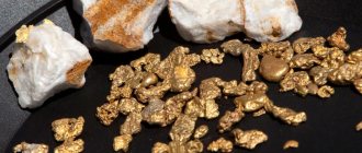
Quartz deposits are among the most attractive. The fact is that they contain so-called native gold with a minimal amount of foreign inclusions. Moreover, in most cases, the metal contains inclusions of silver.
On the territory of the Ural Mountains, which lie only in the Orenburg region, about 150 gold deposits have been discovered. Private prospectors can try their luck on rivers located near:
- Kirovsky (Kvarkensky district);
- Aydyrlinsky (not far from the village of the same name);
- Blakskoe deposits (Svetlinsky district).
In all these areas, the precious metal is mined industrially. In particular, near the village of Aydyrlinsky, gold lies at a depth of more than 100 meters. From the point of view of a private miner, the Ural rivers and local placers will be the most attractive for ore extraction.
Tashkisyu River area
Along the Tashkisyu River near the village of Muldakai, 20 km south of the city of Miass, in 1933 several flat, completely unrounded nuggets were found. The largest of them, weighing 425 g with sharply jagged edges, was located in a flowing swamp, in bluish viscous clay overlying crushed shale. Below the swamp, small gold began to be found along with nuggets. In the area where nuggets are distributed there is a tectonic contact between chromium-bearing serpentines and porphrites, and to the west of the contact there are shales.
Judging by the shape, the nuggets most likely should be associated with the contact shear zone, since the quartz veins located nearby are not gold-bearing. The largest nugget found in the area is a bent plate, smoothed on the convex side and lumpy on the concave side, with a clearly crystalline structure. Since the nugget was located with the convex side up, it was obviously polished by a sandy-clayey water flow rushing through it.
How to get there
By car you need to leave the city of Yekaterinburg towards Verkhnyaya Pyshma, turn towards the village of Baltym. Drive through it and get out onto the old Verkhotursky highway. Further (after about 35 km) you will need to turn right - onto Pervomaisky. After 750 m, a dirt road leading to the deposit will go left into the forest. It starts a few tens of meters from the road. Distance from the center of Yekaterinburg – 57 km.
GPS coordinates of the flooded gold mine pit: N 57° 16.268´; E 60° 44.108´ (or 57.271133°, 60.735133°).
If you drive a little further along the road, you will find yourself in the village of Pervomaisky. You need to drive straight ahead (to the end) and leave the car. Going deeper into the forest, which will be to the right, you will find workings on the site of an ancient mine. The map below will help you navigate. GPS coordinates of the mine behind Pervomaisky: N 57° 16.594´; E 60° 45.919´ (or 57.276567°, 60.765317°).
Pavel Raspopov
Literature: Marakova A., Nepomnyashchiy V. Indigenous gold of Verkhnyaya Pyshma Pervomaisko-Zverevskoye deposit Parishes and churches of the Ekaterinburg diocese. – Ekaterinburg, 1902. Rundkvist N.A., Zadorina O.V. Sverdlovsk region. From A to Z: Illustrated encyclopedia of local history. — Ekaterinburg: “Kvist”, 2009.
Kochkar gold deposit area
In the area of the Kochkar gold deposit in previously mined placers, nuggets larger than 10 g were rarely found; small nuggets were more often found in eluvial debris, oxidized ore veins and accompanying vein rocks - metasomatites (tabashki). In one of these collapses, an original joint was found in the form of kidney-shaped deposits with round holes at the rounded ends. The intergrowth is undoubtedly of secondary origin and was probably formed by replacing the kidney-shaped isolation of iron hydroxides during the oxidation of gold-bearing pyrite cubes, inclusions of which are common in vein selvages.
In a similar collapse there was a block of the same rock with geodes, in one of which inclusions of extremely thin and shiny plates of secondary gold, formed during the oxidation of gold-bearing pyrite, were found.
Historical reference
The Urals is the place where gold was discovered for the first time in Russia and the first mine started working. Unsuccessful searches for gold had been undertaken before, but only in 1745 Erofei Markov found a strange stone with gold inclusions and went with it to Yekaterinburg. He almost paid with his life for his discovery, since mining engineers did not find the precious metal at the place he indicated and suspected him of lying. However, Lomonosov's student, Ignatius Yudin, discovered particles of gold in the ore and in 1747 the first mine of the Berezovsky mine was founded.
Thus, Russia not only acquired its own gold, but also became the only state in the world where the extraction of precious metals begins not from alluvial deposits, but from ore deposits. However, the mine did not immediately begin to bear tangible fruits - the first data on the mined 16 pounds of gold are dated 1754.
First major finds
Exploration for gold deposits continued and by the end of the 18th century, about 140 gold-bearing veins had been identified and dozens of mines had been built. On one of them, in 1842, the largest Russian nugget was found, called the “Big Triangle,” weighing more than 32 kilograms.
But the real gold rush begins with the discovery of deposits of placer gold, which experienced prospector Lev Brusnitsyn purposefully searched for and found on the banks of the Berezovka River.
Not only did he discover a deposit with an easy and inexpensive manual mining method, but he also developed a soil-washing device known as a borehole, or "American", which was subsequently widely used in the mines of California and Alaska.
Area of the Sanarka and Kamenka rivers
The system of the Sanarka and Kamenka rivers, tributaries of the Uy River in the Chelyabinsk region. Gold crystals in rare combinations of cubic crystal forms from placers of the Sanarka and Kamenka river system 20 km south of the Kochkar gold deposit, studied and described by P. V. Eremeev in 1877, are stored in the museum of the St. Petersburg Mining Institute.
Map of the Sanar gold mines (1868)
In the same area of mines with gold crystals on the right side of the Oseika River, 2 km northwest of the village of Kosobrodsky, there is the Kosobrodskaya nugget placer, famous in pre-revolutionary times for exceptionally large nuggets weighing from several units to 20 kg, usually found at large intervals in time and in their distribution along the northwestern-trending drift. The arrangement of the nuggets was linear and discontinuous, suggesting that underground excavation was carried out along the upper boundary of a mineralized thin fault that continues to the northwest in the form of a vein of white quartz, the collapse of which is observed at the surface.
The episode with the last nugget is known. The prospector, after unsuccessfully advancing the drift, left it, and the excavation was continued by another prospector, who after a few meters picked up a pound nugget. The origin of the nuggets still remains unclear.
This can be found out during drilling exploration of the raft along the strike of the vein.
Recommendations for working with a metal detector
If in the case of mini-dredges and mini-sluices it is initially clear how to choose a place for future mining, then when working with a metal detector it is recommended to go to the territory where nuggets weighing more than 50 grams were previously found. This device simply will not detect small gold particles. You can find out in which region relatively large nuggets were previously discovered from geologists or at the local library.
Quite often, large particles of gold are localized in a separate area, forming so-called nodes. Accordingly, once found, a nugget will most likely lead to other large-sized precious metals. It is important to understand that in most cases such deposits have been previously mined. However, during mining, some of the minerals often remain in the ground.
The search for gold-bearing masses in the Urals is carried out on:
- new areas;
- technogenic (spent) placers.
The most preferable search is in new areas. It should be noted that work in such territories often leads to unsatisfactory results. On the other hand, there is a possibility that a small gold mine may be discovered. In addition, there are many unexplored areas in the Urals that could potentially hide precious metals.
Working on technogenic placers is suitable for those who, first of all, want to extract gold. Such areas always contain several grams of precious metal. However, a prospector in technogenic placers will not be able to extract gold in significant quantities.
Gumbey district
In the Gumbey region of the Southern Urals, small and large gold nuggets were often found in placers on both sides of the Gumbeyka River.
Especially large nuggets weighing 24.5; 9.8 and 5.3 kg, as well as many smaller ones, were taken from the northern top of the placer in close proximity to the quartz-gold vein, the ore columns of which were undoubtedly the primary source of the nuggets.
Map of the gold mines of the Southern Urals in 1901
The deep multilayer placer of the neighboring Balkan mine was rich in numerous highly rounded nuggets weighing from tens of grams to several kilograms. A dump of limestone pebbles, left over from sand washing in the pre-revolutionary period, was manually processed by prospectors in the 30s, and several hundred nuggets weighing tens and hundreds of grams were selected.
Two nuggets were interesting for their imprints of pyrite and carbonate crystals. According to foreman S.I. Lazarev, such nuggets were encountered very often before. This can be explained by the fact that the Balkan placer, consisting of several gold-bearing layers over a vertical segment of up to 60 m, is located in the Kordonny Log basin, in the raft and on the sides of which there are numerous quartz gold-bearing veins, most often confined to zones of granites and porphyrites with limestones, jasper-like and siliceous rocks. The composition of the veins was predominantly quartz-carbonate with limited inclusions of sulfides, but with abundant inclusions of pyrite crystals, often in the form of druses.
In the same Gumbey region, in a placer lying on a serpentine raft on the left bank of the Gumbeyka River near the Alexander Nevsky village, numerous rounded nuggets of exclusively wire and hooked shapes were found.
Both in this placer and in the neighboring ones, located downstream of the Gumbeyki River, on its left side, gold was accompanied by fine-plate iridium, which in the pre-revolutionary period, when washing the sands, was dumped along with the concentrate. Its origin should be associated with the serpentine, which occupies a significant area in the area of the Gumbeyka River.
How gold is mined
In the Urals, traditional technologies are used for gold mining using:
- Industrial device. It is not recommended to use industrial equipment for gold mining in the Ural Mountains. The fact is that such an installation traps fairly large particles of metal. However, in local placers, the material is often either included in other minerals or has very small sizes. In addition, Ural gold is hidden under a layer of clay and heavy soil. In Soviet times, devices were used at local deposits that could capture particles ranging in size from 0.5 to 80 mm. Moreover, even the use of such equipment did not exclude numerous losses. According to researchers, industrial devices released up to 15-40% of the gold mass back into the soil. And particles no larger than 0.25 mm in size were not recovered at all. Experts believe that with minimal investments and the organization of small enterprises, up to 7 tons of gold can be extracted annually from already developed Ural deposits.
- Minidrag. Minidrags are autonomous installations through which river sands are washed in order to extract gold particles from them. These devices include pumps that supply the material. Mini dredges are used in various placers and flooded areas where gold-bearing masses may potentially occur.
- Minigates. Mini-sluices have a design similar to mini-drags. The difference in the design of both devices is that the latter are mounted on pontoons. Mini-gates are installed on the banks of gold-bearing rivers. These devices, through a flexible hose, suck in sand, which is fed to a hydraulic screen, where the material is initially purified from impurities. Mini-sluices are also used in dry areas containing gold-bearing strata.
- Metal detector. Another device that private miners use in their work. Depending on the characteristics of the metal detector, it is capable of detecting gold inclusions in the soil layer at a depth of up to 50 cm. Some devices are equipped with a disintegrator that determines the type of mineral rock.
Novice miners also use special trays for washing gold-bearing sand in rivers.
Gogino station area - Bredy
The area of the Gogino-Bredy station of the South Ural Railway. To the south, after approximately an 80-kilometer break, ore and placer gold deposits are found in the area of the South Ural Railway at a distance of 35 km, from the station. Gogino to st. Nonsense. Here, on both sides of the railway, the administrative map of 1936 shows numerous gold mines, mined mainly in pre-revolutionary times, and information about the scale of gold mining has not been preserved, with the exception of oral reports received from S.I. Lazarev.
Large nuggets were found in groups on steppe areas without any signs of drainage topography. Clear signs of ancient work attracted the attention of S.I. Lazarev, and the stripping of peats using manual drainage made it possible to discover in several places on a limestone raft a significant number of nuggets, apparently missed by ancient gold miners due to the lack of drainage devices.
Inspection of these areas suggests that the accumulations of nuggets are of eluvial origin; they are located near the bedrock of rich ore columns. Therefore, it is advisable to conduct detailed exploration in these areas.
Place of Birth
The high popularity of gold mining in the Urals is due to many factors. This region attracts prospectors for the following reasons:
- moderate climatic conditions allowing the extraction of gold-bearing veins within several months;
- absence of permafrost layers, which create additional problems during ore mining;
- successful gold deposits in terms of geographical location.
Gold mining in the Urals is carried out in several ways:
- Handmade or artisanal. Basically, prospectors use the gold-bearing rivers of the Urals to extract metal.
- Ore. Extraction is carried out in mines.
- Use of dredge. In this case, the rivers of the Urals are also used.
- Hydraulic.
Due to the fact that this region contains rich deposits, the ore method is used to extract metal. Examples of local ore deposits are summarized in the table below. This is a kind of map that indicates where to look for gold in the Urals.
| Type of deposit | Peculiarities | Examples of deposits |
| Indigenous | Vein and mineralized zones occur in the Urals. | Koncharskoye, Svetlinskoye, Kurosan (southern and western), Nailinskoye |
| Placers | They are a gold-bearing mass that has accumulated in one place through the transfer of ore and rock by water. | Bolsheshaldinskaya placer, Moss swamp. |
According to experts, up to 15% of the world's gold reserves are hidden in the Ural region. Analysts predict that if current production volumes are maintained, the precious metal will last for about 100 years.
The Urals are one of the richest sources of minerals. The region contains many deposits of precious metals, which are mined by both manual and industrial methods.